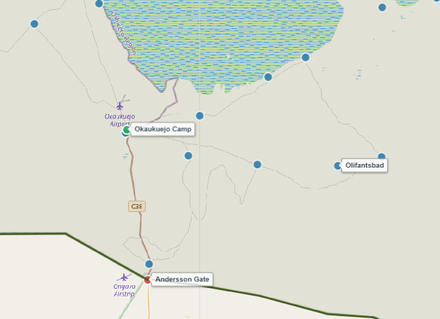
About Olifantsbad Waterhole
Translating to "Elephants' Bath" in Afrikaans, Olifantsbad lives up to its name as one of the most reliable waterholes for observing massive breeding herds of African elephants in central-southern Etosha National Park.
Surrounded by dense mopane woodland and scrubland, Olifantsbad is fed by a solar-powered borehole that fills two large concrete drinking basins. Because the surrounding vegetation offers cover and shelter, large numbers of game gather here during the dry season (May to October), making it an ideal location for close-up wildlife photography from the safety of your vehicle.
Key Facts & Specifications
| Parameter | Details |
|---|---|
| Waterhole Type | Artificial (Solar-Powered Borehole) |
| Structure | Two separate concrete drinking basins |
| Surrounding Vegetation | Mopane woodland, sweet-grass scrubland |
| Best Time of Day | Midday to late afternoon (11:00 – 16:00 for Elephants) |
| Peak Season | Dry Season (June to October) |
| Parking Area | Shaded parking loop with multi-angle views |

Find Waterholes by Animal Species
Looking for specific wildlife in Etosha? Select an animal species—such as Lions, Elephants, or Kudus—in our Wildlife Finder to instantly discover the exact waterholes where you have the highest chances of spotting them.
Wildlife Sightings Matrix
| Species | Probability | Behavior / Notes |
|---|---|---|
| Elephants | Very High (95%) | Breeding herds and large bulls bathing and mud-rolling |
| Red Hartebeest | High (80%) | Frequent visitors in small family groups |
| Plains Zebra | High (85%) | Large herds drinking alongside wildebeests |
| Lions | Medium (45%) | Occasional morning or evening ambush near mopane cover |
| Black Rhino | Low (20%) | Rare daytime visits; mostly shy nocturnal visitors |

Planning a Rest Stop During Your Safari Drive?
Discover fenced picnic areas with shaded seating and toilet facilities near Olifantsbad and across the park.
Distances from Main Rest Camps
| From Camp | Distance | Drive Time (Approx.) |
|---|---|---|
| Okaukuejo Resort | ~ 28 km | ~ 35 – 45 mins |
| Halali Resort | ~ 62 km | ~ 1 hr 15 mins |
| Namutoni Resort | ~ 150 km | ~ 2.5 – 3 hrs |

Calculate Tracks & Export Offline PDF Route
Use our interactive routing engine to calculate distances between gates, camps, and waterholes, and stay informed on active MEFT road deviations (such as the Rhino Drive bypass). Since network signal inside Etosha is very limited, download or print your customized route as an offline PDF before entering the park.
View Olifantsbad on Interactive Map
Waterhole Gallery
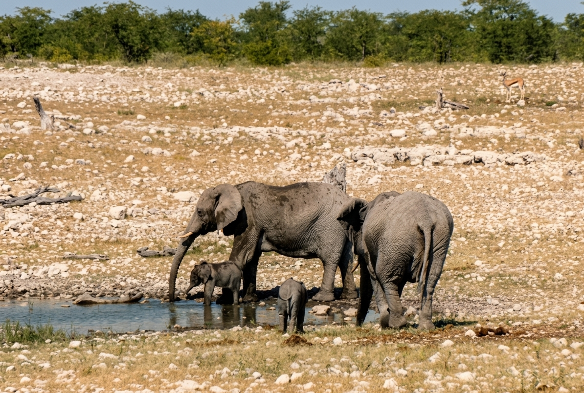
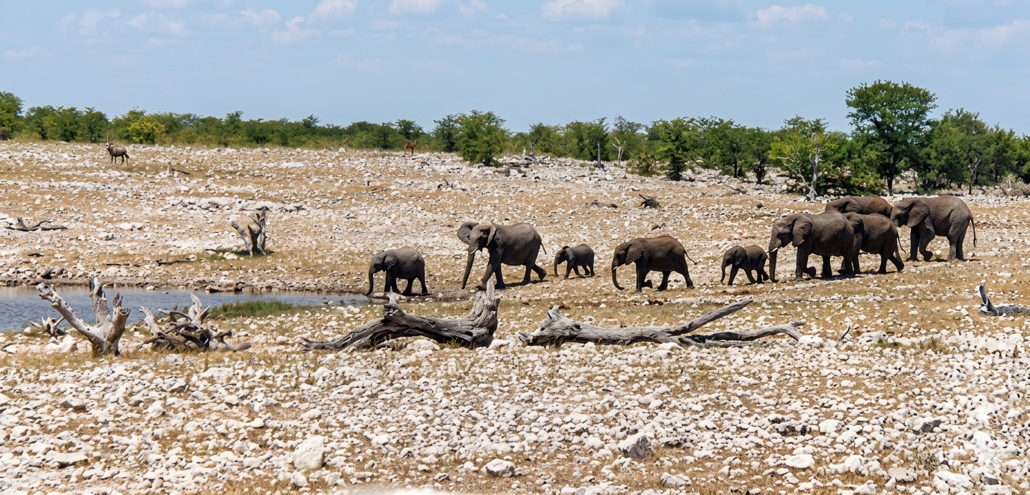
Images property of NWR / Stalin Kay
Quick Facts
- Region Central-Southern Etosha
- GPS Coords 19°12'52.4"S 16°08'44.2"E
- Water Source Solar Borehole
- Key Attraction Elephant Herds
- Photo Quality Excellent (Close-range)
- Shade Nearby Tree Cover