About Okondeka Waterhole
Situated on the far western edge of the Etosha Pan roughly 20 kilometers north-west of Okaukuejo, Okondeka is a natural contact spring where fresh groundwater seeps through sand dunes directly into the vast saline pan. Set against dramatic grassy sand hummocks and sprawling salt flats, it provides one of the most iconic wilderness backdrops in the park.
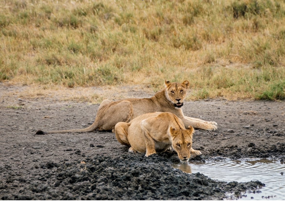
Okondeka is world-renowned among safari enthusiasts as the core territory of the famous Okondeka Lion Pride. The pride frequently rests among the low grassy mounds or hunts large herds of springbok and zebras out on the open flats. The vast, flat terrain is also prime hunting territory for swift cheetahs, while large flocks of ostriches are regularly seen strutting across the shimmering horizon.
Key Facts & Specifications
| Parameter | Details |
|---|---|
| Waterhole Type | Natural Contact Spring (Perennial) |
| Structure | Seeping natural spring basin amidst sand hummocks & pan edge |
| Surrounding Vegetation | Grassy dune hummocks, alkaline flats & open savanna |
| Best Time of Day | Early Morning & Late Afternoon (Lion & Cheetah Activity) |
| Peak Season | Dry Season (June to November) |
| Parking Area | Spacious gravel parking loop offering panoramic pan-edge views |

Hoping to See Lions, Cheetahs, or Ostriches?
Okondeka is legendary for big cat encounters on the open pan. Use our Wildlife Finder to filter Etosha waterholes by your target species and track down active lion territories across the park.
Wildlife Sightings Matrix
| Species | Probability | Behavior / Notes |
|---|---|---|
| Lions | Very High (90%) | Resident pride frequently resting on grassy mounds or stalking on the pan |
| Ostrich | Very High (95%) | Large groups feeding and displaying along the shimmering pan horizon |
| Cheetah | Medium (45%) | Utilizes the vast open grassy plains surrounding the spring for high-speed hunts |
| Springbok & Gemsbok | Very High (95%) | Massive herds gathering on the open flats surrounding the waterhole |
| Black Rhino | Low (20%) | Occasional early morning visits emerging from the western bushveld |

Exploring the Western Pan Circuit?
Okondeka is a popular turnaround point on northern drives from Okaukuejo. Plan full rest breaks and meal stops at nearby facilities inside Okaukuejo Rest Camp or Olifantsrus.
Distances from Main Rest Camps & Gates
| Destination | Distance | Drive Time (Approx.) |
|---|---|---|
| Okaukuejo Resort | ~ 20 km | ~ 25 – 30 mins |
| Olifantsrus Camp | ~ 110 km | ~ 2 hrs |
| Andersson Gate (South) | ~ 37 km | ~ 40 mins |
| Halali Resort | ~ 90 km | ~ 1.5 hrs |

Calculate Western Tracks & Export Offline PDF Routes
Planning a drive around the western pan loop to Okondeka and Wolfsnes? Use our interactive route planner to calculate exact track distances and save a printable PDF route map before heading into areas with limited cell reception.
View Okondeka on Interactive Map
Waterhole Gallery
Images property of NWR / Stalin Kay
Quick Facts
- Region Western Pan Edge (Okaukuejo Sector)
- GPS Coords 18°59'39.0"S 15°51'59.7"E
- Water Source Natural Contact Spring
- Key Attraction Pan Lions, Ostriches & Cheetahs
- Photo Quality Spectacular (Open pan landscapes)
- Shade Vehicle Parking Loop
