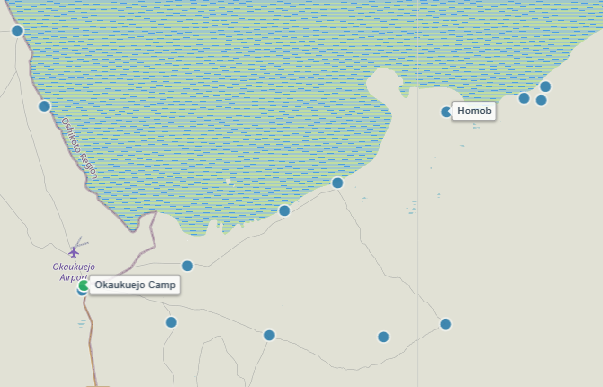
About Homob Waterhole
Nestled in a limestone depression near the southern edge of the vast Etosha Pan, Homob is a scenic natural spring located south-east of Okaukuejo. Set slightly below the surrounding plain level, it provides a natural amphitheater layout that allows self-drive visitors to enjoy elevated, clear views across the entire drinking pool.
Homob is renowned for attracting massive numbers of plains game during the dry winter months. Large family herds of elephants gather here to drink and dust-bathe, while sprawling herds of plains zebras and swift red hartebeests regularly line up along the chalky water edge under the watchful eyes of resident predators.
Key Facts & Specifications
| Parameter | Details |
|---|---|
| Waterhole Type | Natural Limestone Spring (Perennial) |
| Structure | Natural limestone depression pool with open lime-white shoreline |
| Surrounding Vegetation | Open dwarf shrub savanna, sweet-grass plains & chalky flats |
| Best Time of Day | Midday to late afternoon (11:00 – 16:30 for Elephants & Antelope) |
| Peak Season | Dry Season (June to November) |
| Parking Area | Elevated gravel parking loop with panoramic views |

Tracking Elephants, Zebras, or Red Hartebeests?
Homob is a prime watering location for large herbivore herds. Use our Wildlife Finder to filter Etosha waterholes by your target species and pinpoint where game gathers most reliably during your travel dates.
Wildlife Sightings Matrix
| Species | Probability | Behavior / Notes |
|---|---|---|
| Elephants | Very High (90%) | Breeding herds arriving in sequence during afternoon hours |
| Plains Zebra | Very High (95%) | Large herds congregating along the chalky banks |
| Red Hartebeest | High (85%) | Frequent visitors in small to medium breeding groups |
| Lions | Medium (40%) | Occasional morning visits or resting in nearby low scrub cover |
| Oryx (Gemsbok) | High (80%) | Common sight drinking alongside zebras in bright daylight |

Exploring the Southern Pan-Edge Route?
Combine your stop at Homob with a lunch or bathroom break at nearby designated, fenced rest stops like Olifantsbad or Okaukuejo Rest Camp.
Distances from Main Rest Camps & Gates
| Destination | Distance | Drive Time (Approx.) |
|---|---|---|
| Okaukuejo Resort | ~ 42 km | ~ 50 mins – 1 hr |
| Halali Resort | ~ 50 km | ~ 1 hr |
| Andersson Gate (South) | ~ 58 km | ~ 1 hr 10 mins |
| Namutoni Resort | ~ 120 km | ~ 2.2 hrs |

Calculate Southern Tracks & Export Offline PDF Routes
Use our interactive route planner to check distances, navigate active MEFT road deviations (such as the Rhino Drive bypass nearby), and save or print your safari route as a PDF before heading out into low-reception park zones.
View Homob on Interactive Map
Waterhole Gallery
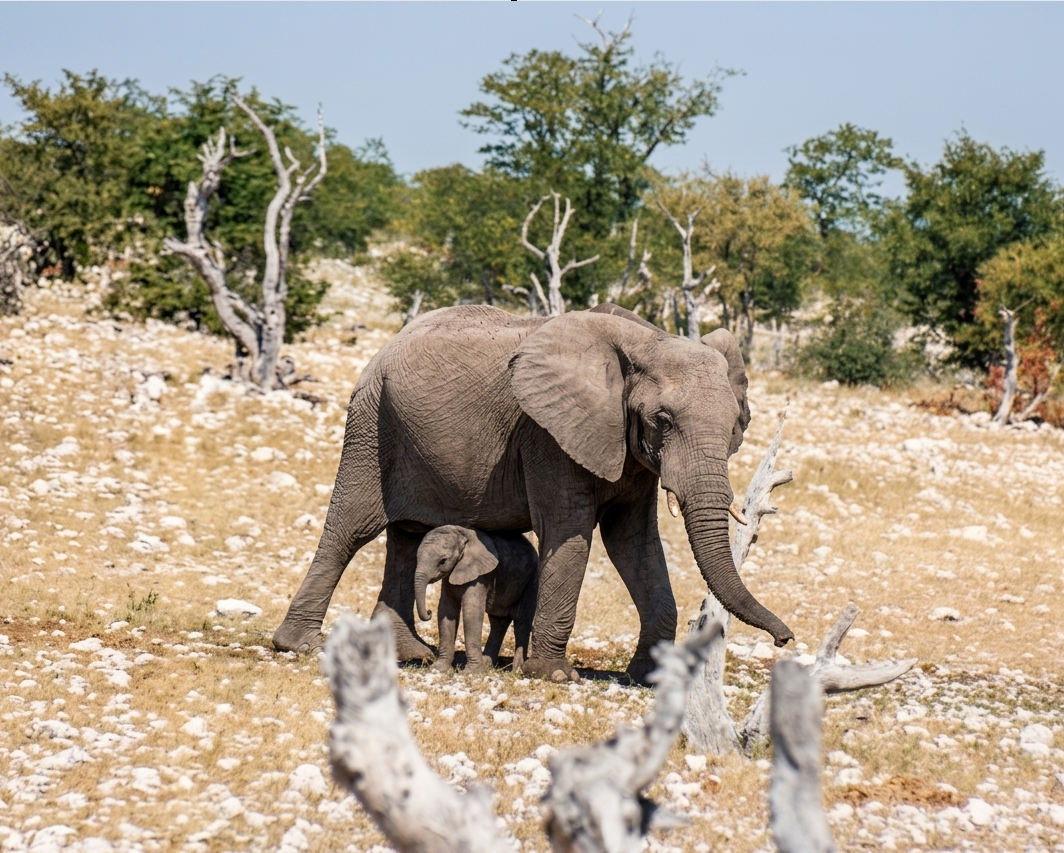
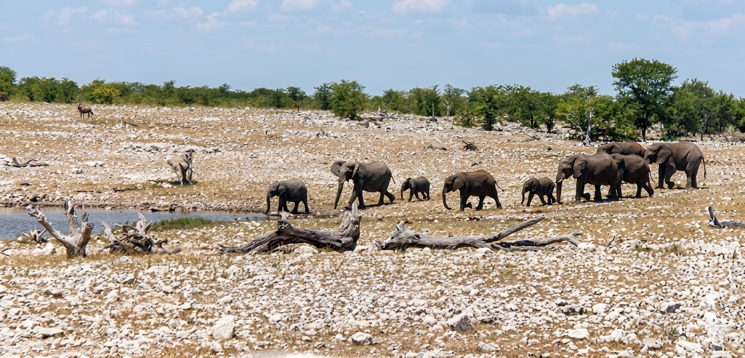
Images property of NWR / Stalin Kay
Quick Facts
- Region Central-Southern Etosha
- GPS Coords 19°03'08.0"S 16°11'37.8"E
- Water Source Limestone Spring (Natural)
- Key Attraction Elephants, Zebras & Hartebeests
- Photo Quality Great (Elevated vantage loop)
- Shade Vehicle Parking Only