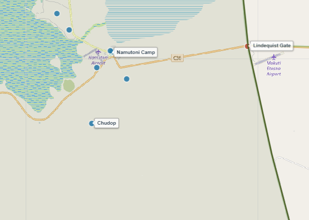
About Chudop Waterhole
Situated just a short drive south-west of Namutoni Resort, Chudop is one of Etosha's most productive natural artesian springs. Fed by strong underground pressure, cold fresh water continuously bubbles up into a large, reed-fringed depression, creating a reliable year-round oasis even during extreme dry spells.
The surrounding terrain mixes open grassy clearings with dense thickets, providing ideal stalking cover for elusive predators like leopards and lions. Huge journeys of giraffes and herds of endemic black-faced impalas visit Chudop daily, offering spectacular, close-range photographic opportunities from the parking loop elevated slightly above the water level.
Key Facts & Specifications
| Parameter | Details |
|---|---|
| Waterhole Type | Natural Artesian Spring (Perennial) |
| Structure | Large natural depression with reed beds & clear open water |
| Surrounding Vegetation | Mixed acacia thornbush & open reed grassland |
| Best Time of Day | Early Morning (Leopards & Cats) / Midday (Giraffes) |
| Peak Season | Year-round (Exceptional June to October) |
| Parking Area | Elevated gravel parking loop with clear sightlines |
Looking to Spot Leopards, Giraffes, or Impala?
Chudop is a top-tier location for stealthy leopards and large giraffe herds. Use our Wildlife Finder to filter Etosha waterholes by your target species and maximize your daily game drive sightings.
Wildlife Sightings Matrix
| Species | Probability | Behavior / Notes |
|---|---|---|
| Giraffe | Very High (95%) | Large groups drinking simultaneously with awkward, iconic postures |
| Leopard | High (65%) | Regular sightings early morning/late afternoon utilizing nearby thickets |
| Black-Faced Impala | Very High (90%) | Endemic subspecies frequently grazing and drinking along the edges |
| Lions | Medium (50%) | Prides often rest in surrounding bush cover or ambush prey |
| Elephants | High (75%) | Breeding herds and solitary bulls drinking fresh spring water |

Exploring the Eastern Sector Near Namutoni?
Combine your visit to Chudop with a relaxing lunch break at nearby designated picnic spots like Dik-Dik Drive or Namutoni Rest Camp facilities.
Distances from Main Rest Camps & Gates
| Destination | Distance | Drive Time (Approx.) |
|---|---|---|
| Namutoni Resort | ~ 11 km | ~ 15 mins |
| Von Lindequist Gate (East) | ~ 22 km | ~ 25 mins |
| Halali Resort | ~ 60 km | ~ 1 hr 10 mins |
| Okaukuejo Resort | ~ 130 km | ~ 2.5 hrs |

Planning Eastern Routes & Exporting Offline PDFs
Use our interactive route planner to map drives around the eastern pan loop (including Chudop, Klein Namutoni, and Kalkheuwel) and export a printable offline PDF route map before entering areas with weak cellular coverage.
View Chudop on Interactive Map
Waterhole Gallery
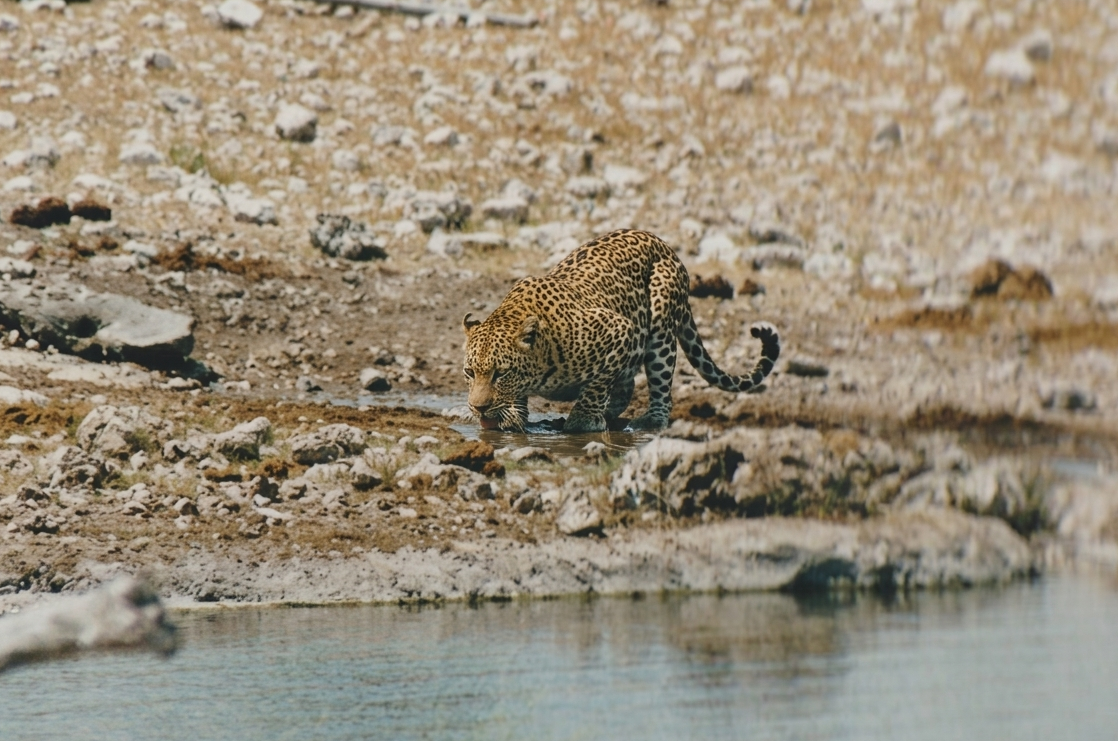
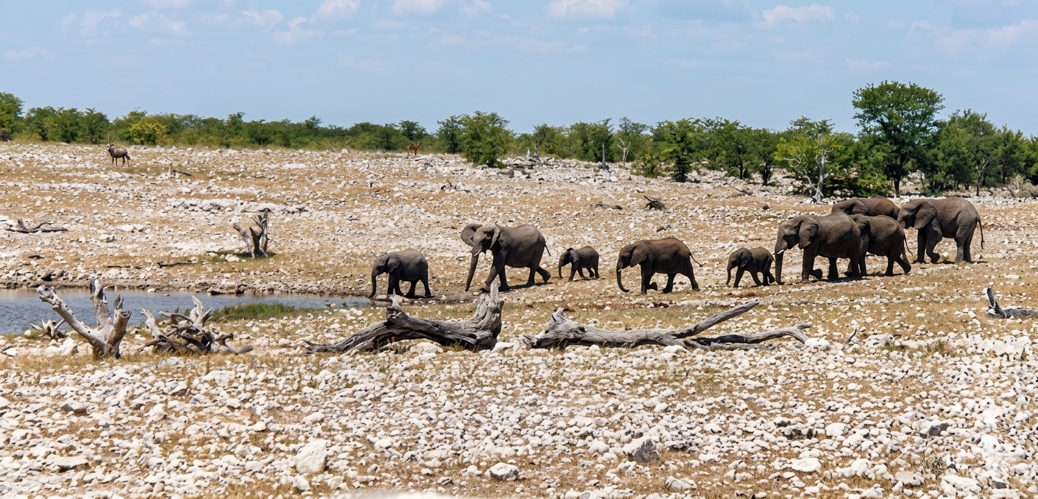
Images property of NWR / Stalin Kay
Quick Facts
- Region Eastern Etosha (Namutoni Area)
- GPS Coords 18°51'31.5"S 16°55'29.2"E
- Water Source Artesian Spring (Natural)
- Key Attraction Giraffes, Leopards & Impalas
- Photo Quality Exceptional (Elevated angle)
- Shade Vehicle Parking Only